English   Română   Español   Français   Deutsch  

getamap.net

Africa

Oceania

Asia

North America

Europe

South America

Antarctica


Les Reuses

/ Jersey (general)

49°15'2" N
2°10'30" W
~1m asl
11:44 (BST - UTC/GMT+1)

Les Reuses (Les Reuses) is a point (class T - Hypsographic) in Jersey (general), Jersey [ United Kingdom ] (Europe) with the region font code of Americas/Western Europe. It is located at an elevation of 1 meters above sea level.

Its coordinates are 49°15'2" N and 2°10'30" W in DMS (Degrees Minutes Seconds) or 49.2506 and -2.175 (in decimal degrees). Its UTM position is WV65 and its Joint Operation Graphics reference is NM30-08.

Current local time is 11:44; the sun rises at 07:54 and sets at 20:01 local time (Europe/Jersey UTC/GMT+1). The standard time zone for Les Reuses is UTC/GMT+0, but since Daylight Saving Time (DST) is in effect the current time zone is UTC/GMT+1.
In 2024 DST starts on 31 Mar 2024 and ends on 27 Oct 2024.

A Point is a tapering piece of land projecting into a body of water, less prominent than a cape.


Country
 Advertisements:


 Advertisements:


Weather Les Reuses (Cloud cover, Temperature, Wind speed and Precipitation mm probab.)

Sat


Apr 27
Clound 10-80-100-80 Mist
~9 l/m2 88%
 
8 °C min
10 °C max
30 km/h
Thu Jan 1

Sun


Apr 28
Clound 20-60-20-20 Mist
~7 l/m2 72%
 
9 °C min
12 °C max
45 km/h
Thu Jan 1

Mon


Apr 29
Clound 10-10-40-40
 
9 °C min
13 °C max
32 km/h
Thu Jan 1

Tue


Apr 30
Clound 10-70-60-50
~8 l/m2 78%
 
10 °C min
12 °C max
43 km/h
Thu Jan 1

Wed


May 1
Clound 20-90-100-60
~11 l/m2 81%
 
9 °C min
12 °C max
29 km/h
Thu Jan 1

Thu


May 2
Clound 10-90-90-90 Mist
~18 l/m2 96%
 
10 °C min
12 °C max
43 km/h
Thu Jan 1

Weather Graph

Les Reuses (Jersey (general)) 7 day forecast
 

Map and Photos Les Reuses


Comments

--- There are no comments yet ---


Add a new comment:


You have to log in to add a comment!


Members area


Register

Forgot password?

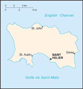
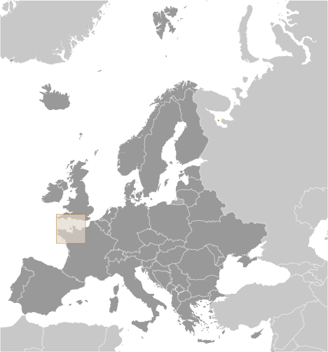
Jersey [ United Kingdom ] (British Crown Dependency):

Advertisement


GPS points near Les Reuses


square Isle Agois (0.5km)

square Crabbe (0.5km)

square La Falaise (0.5km)

square L'Ane (0.5km)

square Les Mouriers (0.5km)

square Le Rondin (1 km)

square La Plaine (1 km)


square Le Fosse Vicq (1 km)

square Saint Mary (1 km)

square The Demies (1 km)

square Greve de Lecq (1 km)

square Rouge Nez (1 km)

square Sorel Point (1 km)

square La Houle (2 km)

square Grune de Vicq (2 km)


GPS points from Jersey [ United Kingdom ] (British Crown Dependency)

square Douet De La Mer Jersey (general)

square La Falaise Jersey (general)

square La Rousse Platte Jersey (general)

square Havre De Fontaines Jersey (general)

square La Moye Jersey (general)

square Saint Catherine Bay Jersey (general)

square Grande Mangeuse Jersey (general)

square La Greve D' Azette Jersey (general)


viewweather.com sv.ViewWeather.com
fr.ViewWeather.com
da.ViewWeather.com
de.ViewWeather.com
es.ViewWeather.com
www.carpati.org
www.searchromania.net
Deblocari usi
es.getamap.org
fr.getamap.org
de.getamap.org
nl.getamap.org
da.getamap.org
www.getamap.org
Links
Terms of use
Privacy policy

# 0.0656 sec 

contact AT getamap.net

© 2006 - 2024  https://www.getamap.net/